 vesseltracker.com
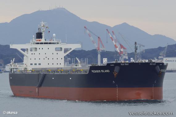
 PEGASUS ISLAND
Current Status
Where is the vessel?
PEGASUS ISLAND is currently in 22 nm NW of Oga, based on AIS data received about 4h ago.
Latest AIS update:
Current position: 40.04350° N, 139.41293° E (22 nm NW of Oga)
Average speed (last 7 days): Loading…
Average speed (last 30 days): Loading…
Vessel profile: PEGASUS ISLAND is a Bulk Carrier with dimensions 38m x 230m.
This page combines live AIS, route history, probable destination signals, nearby traffic, and port activity for practical vessel monitoring.
The current position of vessel PEGASUS ISLAND is 40.04350 lat / 139.41293 lng. Updated: 2026-04-12 12:13:54 UTCNearest reference points:
- Near Yokohama, Aomori
- 11 nm NW of Yokohama, Aomori
- Near Shiogama
Currently sailing under the flag of Japan ![]()
PEGASUS ISLAND built in 2018 year
Deadweight:
88876 tDetails:
Live Vessel PEGASUS ISLAND Analytics (details, animations, etc.)
Recent AIS points (UTC):
2026-04-12 10:02:13 UTC · 40.02693, 139.36183 · SOG 1.5 kn · COG 344°2026-04-12 10:36:10 UTC · 40.03195, 139.37682 · SOG 1 kn · COG 341°
2026-04-12 12:13:54 UTC · 40.04350, 139.41293 · SOG 1 kn · COG 349°
2026-04-12 12:13:54 UTC · 40.04350, 139.41293 · SOG 1 kn · COG 349°