 vesseltracker.com
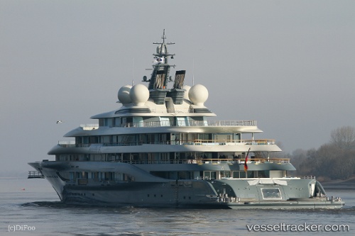
 FLYING FOX
Current Status
Where is the vessel?
FLYING FOX is currently in Near Bahrenfeld, based on AIS data received about 80d ago.
Latest AIS update:
Current position: 53.54196° N, 9.95519° E (Near Bahrenfeld)
Average speed (last 7 days): Loading…
Average speed (last 30 days): Loading…
Vessel profile: FLYING FOX is a Pleasure Craft with dimensions m x m.
This page combines live AIS, route history, probable destination signals, nearby traffic, and port activity for practical vessel monitoring.
The current position of vessel FLYING FOX is 53.54196 lat / 9.95519 lng. Updated: 2026-01-21 20:20:13 UTCNearest reference points:
- Near Bahrenfeld
- Near Hamburg-Mitte
- Near Allermöhe
Currently sailing under the flag of Malaysia ![]()
Details:
Live Vessel FLYING FOX Analytics (details, animations, etc.)
Recent AIS points (UTC):
2026-01-21 20:20:13 UTC · 53.54196, 9.95519 · SOG 0.2 kn · COG -1°