 vesseltracker.com
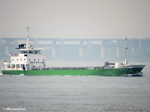
Kaiun Maru
Current StatusWhere is the vessel?
Kaiun Maru is currently in Near Ube, based on AIS data received about 1h ago.
Latest AIS update:
Current position: 33.85668° N, 131.33130° E (Near Ube)
Average speed (last 7 days): Loading…
Average speed (last 30 days): Loading…
Vessel profile: Kaiun Maru is a General Cargo Ship with dimensions 10m x 62m.
This page combines live AIS, route history, probable destination signals, nearby traffic, and port activity for practical vessel monitoring.
The current position of vessel Kaiun Maru is 33.85668 lat / 131.33130 lng. Updated: 2026-04-22 13:56:25 UTCNearest reference points:
- Near Ube
- 12 nm SE of Ube
- Near KANDA
Details:
Live Vessel Kaiun Maru Analytics (details, animations, etc.)
Recent AIS points (UTC):
2026-04-22 10:30:35 UTC · 33.87893, 130.75056 · SOG 0.1 kn · COG 111°2026-04-22 12:24:24 UTC · 33.95738, 131.05067 · SOG 10.7 kn · COG 118°
2026-04-22 13:40:51 UTC · 33.86567, 131.27948 · SOG 10.1 kn · COG 101°
2026-04-22 13:56:25 UTC · 33.85668, 131.33130 · SOG 10.2 kn · COG 101°