 vesseltracker.com
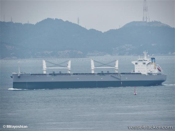
Mamma Mia
Current StatusWhere is the vessel?
Mamma Mia is currently in 278 nm SW of Fort Hunter Liggett, based on AIS data received less than 1h ago.
Latest AIS update:
Current position: 32.73423° N, 125.87402° W (278 nm SW of Fort Hunter Liggett)
Average speed (last 7 days): Loading…
Average speed (last 30 days): Loading…
Vessel profile: Mamma Mia is a Bulk Carrier with dimensions 32m x 199m.
This page combines live AIS, route history, probable destination signals, nearby traffic, and port activity for practical vessel monitoring.
The current position of vessel Mamma Mia is 32.73423 lat / -125.87402 lng. Updated: 2026-04-20 03:29:29 UTCNearest reference points:
- Open sea, approx. 402 nm off the nearest listed port
- Open sea, approx. 403 nm off the nearest listed port
- Open sea, approx. 407 nm off the nearest listed port
Details:
Live Vessel Mamma Mia Analytics (details, animations, etc.)
Recent AIS points (UTC):
2026-04-19 23:42:39 UTC · 33.18493, -126.57966 · SOG 11.9 kn · COG 128°2026-04-20 01:25:02 UTC · 32.98258, -126.25899 · SOG 11.9 kn · COG 127°
2026-04-20 01:25:02 UTC · 32.98258, -126.25899 · SOG 11.9 kn · COG 127°
2026-04-20 03:29:29 UTC · 32.73423, -125.87402 · SOG 12.2 kn · COG 129°