 vesseltracker.com
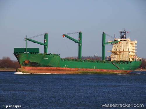
Vessel Cinzia A IMO: 9226516, MMSI: 215421000 Container Ship
UTC, 38.8513, 26.6805, course: 342, speed: 1.2
UTC, 38.8271, 26.6318, course: 345, speed: 0.9
2026-03-04 22:24:12 UTC, 38.8099, 26.6148, course: 284, speed: 0.7
Live Vessel Cinzia A Analytics (details, animations, etc.)
Live AIS position: UTC. 10 nm NW of FOCA), updated 2026-03-04 22:24:12 UTC.Find the position of the vessel Cinzia A on the map. The latter are known coordinates and path.
marine traffic ship tracker show on live map
The current position of vessel Cinzia A is 38.8099 lat / 26.6148 lng. Updated: 2026-03-04 22:24:12 UTCCurrently sailing under the flag of Malta
Cinzia A built in 2001 year
Deadweight:
33894 tDetails:
Last coordinates of the vessel:
UTC, 38.8593, 26.7197, course: 339, speed: 0.8UTC, 38.8513, 26.6805, course: 342, speed: 1.2
UTC, 38.8271, 26.6318, course: 345, speed: 0.9
2026-03-04 22:24:12 UTC, 38.8099, 26.6148, course: 284, speed: 0.7