 vesseltracker.com
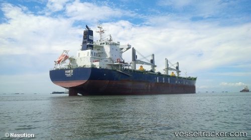
Vessel Hako IMO: 9691814, MMSI: 229697000 Bulk Carrier
UTC, 49.33366, -123.24231, course: 269, speed: 0
UTC, 49.33212, -123.24571, course: 34, speed: 0.2
2026-03-05 05:34:14 UTC, 49.33341, -123.24652, course: 79, speed: 0.1
Live Vessel Hako Analytics (details, animations, etc.)
Live AIS position: UTC. Near Burrard Inlet), updated 2026-03-05 05:34:14 UTC.Find the position of the vessel Hako on the map. The latter are known coordinates and path.
marine traffic ship tracker show on live map
The current position of vessel Hako is 49.33341 lat / -123.24652 lng. Updated: 2026-03-05 05:34:14 UTCDetails:
Last coordinates of the vessel:
UTC, 49.33412, -123.24227, course: 246, speed: 0UTC, 49.33366, -123.24231, course: 269, speed: 0
UTC, 49.33212, -123.24571, course: 34, speed: 0.2
2026-03-05 05:34:14 UTC, 49.33341, -123.24652, course: 79, speed: 0.1