 vesseltracker.com
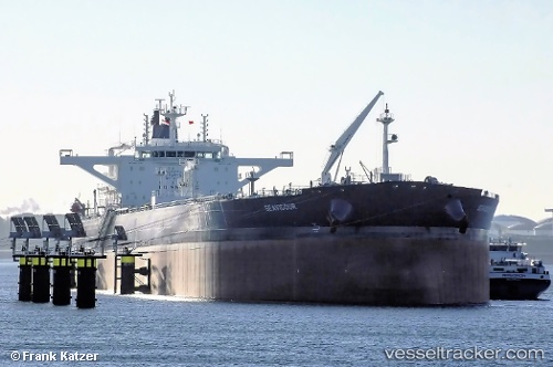
Vessel Seavigour IMO: 9774185, MMSI: 249349000 Crude Oil Tanker
UTC, 26.50113, -78.77377, course: 128, speed: 0
UTC, 26.50114, -78.77377, course: 128, speed: 0
2026-03-04 22:05:46 UTC, 26.50114, -78.77374, course: 128, speed: 0
Live Vessel Seavigour Analytics (details, animations, etc.)
Live AIS position: UTC. Near Freeport), updated 2026-03-04 22:05:46 UTC.Find the position of the vessel Seavigour on the map. The latter are known coordinates and path.
marine traffic ship tracker show on live map
The current position of vessel Seavigour is 26.50114 lat / -78.77374 lng. Updated: 2026-03-04 22:05:46 UTCDetails:
Last coordinates of the vessel:
UTC, 26.50113, -78.77375, course: 128, speed: 0UTC, 26.50113, -78.77377, course: 128, speed: 0
UTC, 26.50114, -78.77377, course: 128, speed: 0
2026-03-04 22:05:46 UTC, 26.50114, -78.77374, course: 128, speed: 0