 vesseltracker.com
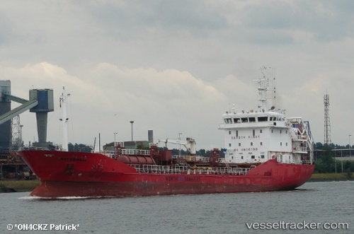
 ADIYAMAN
Current Status
Where is the vessel?
ADIYAMAN is currently in Near Kumport, based on AIS data received about 1d ago.
Latest AIS update:
Current position: 40.94453° N, 28.77549° E (Near Kumport)
Average speed (last 7 days): Loading…
Average speed (last 30 days): Loading…
Vessel profile: ADIYAMAN is a Oil/Chemical Tanker with dimensions m x m.
This page combines live AIS, route history, probable destination signals, nearby traffic, and port activity for practical vessel monitoring.
The current position of vessel ADIYAMAN is 40.94453 lat / 28.77549 lng. Updated: 2026-04-10 07:43:21 UTCNearest reference points:
- Near Kumport
- Near Küçükçekmece
- Near Ambarli
Currently sailing under the flag of Portugal ![]()
Details:
Live Vessel ADIYAMAN Analytics (details, animations, etc.)
Recent AIS points (UTC):
2026-04-10 02:13:50 UTC · 40.94462, 28.77568 · SOG 0 kn · COG 102°2026-04-10 04:04:40 UTC · 40.94472, 28.77598 · SOG 0 kn · COG 109°
2026-04-10 05:34:20 UTC · 40.94466, 28.77584 · SOG 0.1 kn · COG 116°
2026-04-10 07:43:21 UTC · 40.94453, 28.77549 · SOG 0.1 kn · COG 113°