 vesseltracker.com
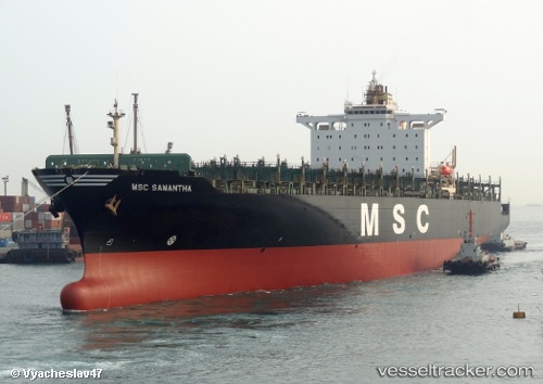
Vessel Msc Samantha IMO: 9110377, MMSI: 356249000 Container Ship
UTC, 36.92667, -12.45333, course: -1, speed: 16
UTC, 37.24667, -12.44667, course: -1, speed: 16
2026-03-05 16:18:09 UTC, 38.04667, -12.43833, course: -1, speed: 16
Live Vessel Msc Samantha Analytics (details, animations, etc.)
Live AIS position: UTC. 99 nm W of Los Ramos), updated 2026-03-05 16:18:09 UTC.Find the position of the vessel Msc Samantha on the map. The latter are known coordinates and path.
marine traffic ship tracker show on live map
The current position of vessel Msc Samantha is 38.04667 lat / -12.43833 lng. Updated: 2026-03-05 16:18:09 UTCCurrently sailing under the flag of Panama
Msc Samantha built in 1996 year
Deadweight:
68363 tDetails:
Last coordinates of the vessel:
UTC, 36.06290, -12.46459, course: -1, speed: 17UTC, 36.92667, -12.45333, course: -1, speed: 16
UTC, 37.24667, -12.44667, course: -1, speed: 16
2026-03-05 16:18:09 UTC, 38.04667, -12.43833, course: -1, speed: 16