 vesseltracker.com
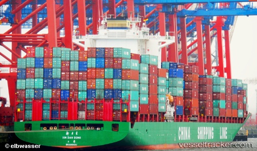
Vessel Xin Dan Dong IMO: 9312597, MMSI: 413153000 Container Ship
UTC, 53.65881, -152.26077, course: 106, speed: 17.3
UTC, 53.41867, -150.98817, course: 108, speed: 17.3
2026-03-05 00:02:05 UTC, 53.41867, -150.98817, course: 108, speed: 17.3
Live Vessel Xin Dan Dong Analytics (details, animations, etc.)
Live AIS position: UTC. 83 nm NW of Kings Bromley), updated 2026-03-05 00:02:05 UTC.Find the position of the vessel Xin Dan Dong on the map. The latter are known coordinates and path.
marine traffic ship tracker show on live map
The current position of vessel Xin Dan Dong is 53.41867 lat / -150.98817 lng. Updated: 2026-03-05 00:02:05 UTCDetails:
Last coordinates of the vessel:
UTC, 53.65881, -152.26077, course: 106, speed: 17.3UTC, 53.65881, -152.26077, course: 106, speed: 17.3
UTC, 53.41867, -150.98817, course: 108, speed: 17.3
2026-03-05 00:02:05 UTC, 53.41867, -150.98817, course: 108, speed: 17.3