 vesseltracker.com
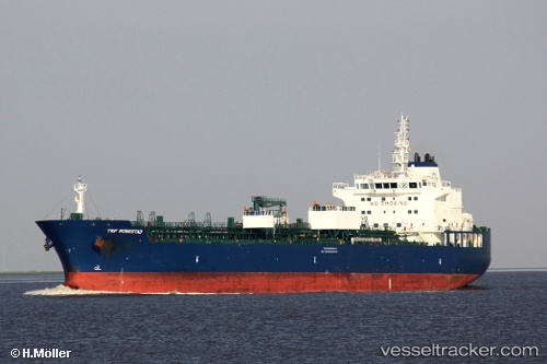
Vessel Trf Mongstad IMO: 9732814, MMSI: 538006544 Chemical Oil Products Tanker
UTC, 24.57442, -86.01226, course: -1, speed: 12.1
UTC, 24.79500, -86.34500, course: -1, speed: 13
2026-03-05 05:24:38 UTC, 25.01833, -86.69500, course: -1, speed: 13
Live Vessel Trf Mongstad Analytics (details, animations, etc.)
Live AIS position: UTC. 204 nm NW of Santa Lucia), updated 2026-03-05 05:24:38 UTC.Find the position of the vessel Trf Mongstad on the map. The latter are known coordinates and path.
marine traffic ship tracker show on live map
The current position of vessel Trf Mongstad is 25.01833 lat / -86.69500 lng. Updated: 2026-03-05 05:24:38 UTCCurrently sailing under the flag of Marshall Is
Details:
Last coordinates of the vessel:
UTC, 24.32167, -85.61833, course: -1, speed: 12UTC, 24.57442, -86.01226, course: -1, speed: 12.1
UTC, 24.79500, -86.34500, course: -1, speed: 13
2026-03-05 05:24:38 UTC, 25.01833, -86.69500, course: -1, speed: 13