 vesseltracker.com
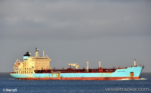
Vessel Maersk Bering IMO: 9299422, MMSI: 563654000 Chemical Oil Products Tanker
UTC, 1.22747, 103.80154, course: 322, speed: 0.1
UTC, 1.22737, 103.80032, course: 20, speed: 0.2
2026-03-04 23:43:39 UTC, 1.22892, 103.79954, course: 101, speed: 0.1
Live Vessel Maersk Bering Analytics (details, animations, etc.)
Live AIS position: UTC. Near Pasir Panjang Wharves), updated 2026-03-04 23:43:39 UTC.Find the position of the vessel Maersk Bering on the map. The latter are known coordinates and path.
marine traffic ship tracker show on live map
The current position of vessel Maersk Bering is 1.22892 lat / 103.79954 lng. Updated: 2026-03-04 23:43:39 UTCDetails:
Last coordinates of the vessel:
UTC, 1.22744, 103.80138, course: 331, speed: 0.1UTC, 1.22747, 103.80154, course: 322, speed: 0.1
UTC, 1.22737, 103.80032, course: 20, speed: 0.2
2026-03-04 23:43:39 UTC, 1.22892, 103.79954, course: 101, speed: 0.1