 vesseltracker.com
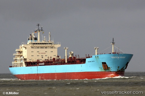
Vessel Maersk Kaya IMO: 9431288, MMSI: 566030000 Chemical Oil Products Tanker
UTC, 40.27922, -20.35830, course: 236, speed: 12.6
UTC, 40.17156, -20.53785, course: 237, speed: 12.5
2026-03-04 23:58:07 UTC, 39.70033, -21.35277, course: 237, speed: 12.3
Live Vessel Maersk Kaya Analytics (details, animations, etc.)
Live AIS position: UTC. 145 nm SE of Kormísta), updated 2026-03-04 23:58:07 UTC.Find the position of the vessel Maersk Kaya on the map. The latter are known coordinates and path.
marine traffic ship tracker show on live map
The current position of vessel Maersk Kaya is 39.70033 lat / -21.35277 lng. Updated: 2026-03-04 23:58:07 UTCDetails:
Last coordinates of the vessel:
UTC, 40.43636, -20.09505, course: 237, speed: 13UTC, 40.27922, -20.35830, course: 236, speed: 12.6
UTC, 40.17156, -20.53785, course: 237, speed: 12.5
2026-03-04 23:58:07 UTC, 39.70033, -21.35277, course: 237, speed: 12.3