 vesseltracker.com
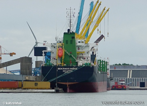
Vessel Benjamas Naree IMO: 9464027, MMSI: 566377000 Bulk Carrier
UTC, 20.89650, -18.58104, course: 210, speed: 11.6
UTC, 19.80449, -19.14208, course: 206, speed: 12
2026-03-05 00:16:01 UTC, 19.42805, -19.33183, course: 207, speed: 11.5
Live Vessel Benjamas Naree Analytics (details, animations, etc.)
Live AIS position: UTC. 148 nm SW of Port Etienne), updated 2026-03-05 00:16:01 UTC.Find the position of the vessel Benjamas Naree on the map. The latter are known coordinates and path.
marine traffic ship tracker show on live map
The current position of vessel Benjamas Naree is 19.42805 lat / -19.33183 lng. Updated: 2026-03-05 00:16:01 UTCDetails:
Last coordinates of the vessel:
UTC, 20.89650, -18.58104, course: 210, speed: 11.6UTC, 20.89650, -18.58104, course: 210, speed: 11.6
UTC, 19.80449, -19.14208, course: 206, speed: 12
2026-03-05 00:16:01 UTC, 19.42805, -19.33183, course: 207, speed: 11.5