 vesseltracker.com
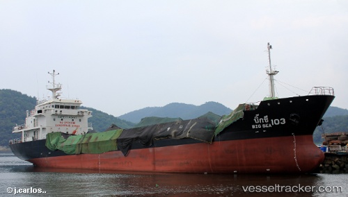
 BIG SEA 103
Current Status
Where is the vessel?
BIG SEA 103 is currently in 15 nm N of Ban Don, based on AIS data received about 1h ago.
Latest AIS update:
Current position: 9.41507° N, 99.43709° E (15 nm N of Ban Don)
Average speed (last 7 days): Loading…
Average speed (last 30 days): Loading…
Vessel profile: BIG SEA 103 is a Tanker with dimensions m x m.
This page combines live AIS, route history, probable destination signals, nearby traffic, and port activity for practical vessel monitoring.
The current position of vessel BIG SEA 103 is 9.41507 lat / 99.43709 lng. Updated: 2026-04-05 01:47:49 UTCNearest reference points:
- Near Nakhon Si Thammarat
- Near Ko Samui
- Near Samui Apt
Currently sailing under the flag of Thailand ![]()
Details:
Live Vessel BIG SEA 103 Analytics (details, animations, etc.)
Recent AIS points (UTC):
2026-04-04 19:37:10 UTC · 10.02493, 99.94399 · SOG 10.8 kn · COG 242°2026-04-04 21:25:41 UTC · 9.89052, 99.64493 · SOG 10.8 kn · COG 246°
2026-04-04 23:56:00 UTC · 9.51025, 99.44597 · SOG 10.7 kn · COG 185°
2026-04-05 01:47:49 UTC · 9.41507, 99.43709 · SOG 0 kn · COG 209°