 vesseltracker.com
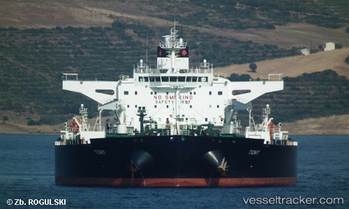
Vessel Tony IMO: 9432036, MMSI: 636014499 Crude Oil Tanker
UTC, 37.11038, 1.99661, course: -1, speed: 11.8
UTC, 37.25322, 2.70762, course: 78, speed: 12.5
2026-03-05 08:24:52 UTC, 37.32212, 3.24048, course: 83, speed: 12.9
Live Vessel Tony Analytics (details, animations, etc.)
Live AIS position: UTC. 32 nm N of Ain Taya), updated 2026-03-05 08:24:52 UTC.Find the position of the vessel Tony on the map. The latter are known coordinates and path.
marine traffic ship tracker show on live map
The current position of vessel Tony is 37.32212 lat / 3.24048 lng. Updated: 2026-03-05 08:24:52 UTCDetails:
Last coordinates of the vessel:
UTC, 36.99759, 1.48264, course: -1, speed: 12.3UTC, 37.11038, 1.99661, course: -1, speed: 11.8
UTC, 37.25322, 2.70762, course: 78, speed: 12.5
2026-03-05 08:24:52 UTC, 37.32212, 3.24048, course: 83, speed: 12.9