 vesseltracker.com
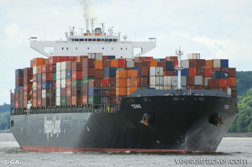
Vessel Teno IMO: 9447859, MMSI: 636092781 Container Ship
UTC, 33.32237, -61.43165, course: 306, speed: 16.6
UTC, 33.51831, -61.76620, course: 306, speed: 16.6
2026-03-05 11:15:57 UTC, 33.78110, -62.20294, course: 306, speed: 17.2
Live Vessel Teno Analytics (details, animations, etc.)
Live AIS position: UTC. 150 nm NE of Saint George), updated 2026-03-05 11:15:57 UTC.Find the position of the vessel Teno on the map. The latter are known coordinates and path.
marine traffic ship tracker show on live map
The current position of vessel Teno is 33.78110 lat / -62.20294 lng. Updated: 2026-03-05 11:15:57 UTCCurrently sailing under the flag of Liberia
Teno built in 2011 year
Deadweight:
94526 tDetails:
Last coordinates of the vessel:
UTC, 32.87112, -60.64709, course: 304, speed: 16.6UTC, 33.32237, -61.43165, course: 306, speed: 16.6
UTC, 33.51831, -61.76620, course: 306, speed: 16.6
2026-03-05 11:15:57 UTC, 33.78110, -62.20294, course: 306, speed: 17.2