 vesseltracker.com
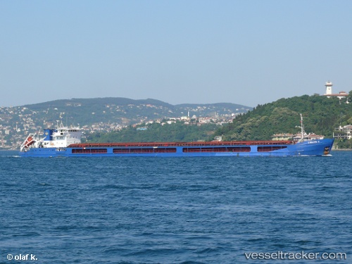
Vessel Chelsea 2 IMO: 9314442, MMSI: 256365000 Multi Purpose Carrier
UTC, 40.35312, 27.95880, course: -1, speed: 0
UTC, 40.35309, 27.95882, course: -1, speed: 0
2026-03-04 17:54:50 UTC, 40.35311, 27.95882, course: -1, speed: 0
Live Vessel Chelsea 2 Analytics (details, animations, etc.)
Live AIS position: UTC. Near Erdek), updated 2026-03-04 17:54:50 UTC.Find the position of the vessel Chelsea 2 on the map. The latter are known coordinates and path.
marine traffic ship tracker show on live map
The current position of vessel Chelsea 2 is 40.35311 lat / 27.95882 lng. Updated: 2026-03-04 17:54:50 UTCCurrently sailing under the flag of Malta
Chelsea 2 built in 2005 year
Deadweight:
6081 tDetails:
Last coordinates of the vessel:
UTC, 40.35308, 27.95879, course: -1, speed: 0UTC, 40.35312, 27.95880, course: -1, speed: 0
UTC, 40.35309, 27.95882, course: -1, speed: 0
2026-03-04 17:54:50 UTC, 40.35311, 27.95882, course: -1, speed: 0