 vesseltracker.com
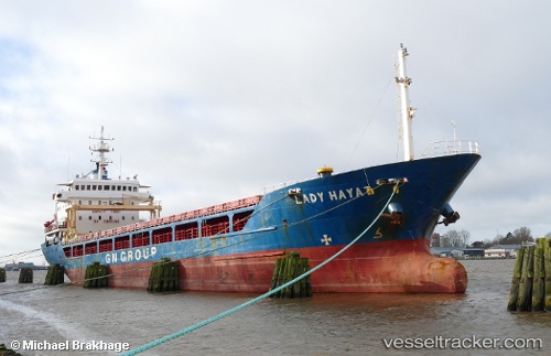
Vessel Lady Hayat IMO: 9075450, MMSI: 373628000 General Cargo Ship
UTC, 40.82391, 29.01096, course: 5, speed: 8.8
UTC, 41.12776, 29.08096, course: 327, speed: 9.5
2026-02-21 14:19:07 UTC, 41.26696, 29.32062, course: 78, speed: 10.4
Live AIS position:
UTC. Near RUMELI FENERI),
updated 2026-02-21 14:19:07 UTC.
Find the position of the vessel Lady Hayat on the map. The latter are known coordinates and path.
marine traffic ship tracker show on live map
The current position of vessel Lady Hayat is 41.26696 lat / 29.32062 lng. Updated: 2026-02-21 14:19:07 UTCCurrently sailing under the flag of Panama
Lady Hayat built in 1995 year
Deadweight:
5264 tDetails:
Last coordinates of the vessel:
UTC, 40.97209, 28.91991, course: 77, speed: 3.9UTC, 40.82391, 29.01096, course: 5, speed: 8.8
UTC, 41.12776, 29.08096, course: 327, speed: 9.5
2026-02-21 14:19:07 UTC, 41.26696, 29.32062, course: 78, speed: 10.4