 vesseltracker.com
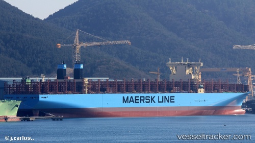
Maastricht Maersk
Current StatusWhere is the vessel?
Maastricht Maersk is currently in 172 nm E of Richards Bay, based on AIS data received about 1h ago.
Latest AIS update:
Current position: 28.99493° S, 35.40605° E (172 nm E of Richards Bay)
Average speed (last 7 days): Loading…
Average speed (last 30 days): Loading…
Vessel profile: Maastricht Maersk is a Container Ship with dimensions 58m x 399m.
This page combines live AIS, route history, probable destination signals, nearby traffic, and port activity for practical vessel monitoring.
The current position of vessel Maastricht Maersk is -28.99493 lat / 35.40605 lng. Updated: 2026-05-13 11:24:21 UTCNearest reference points:
- 163 nm SE of Richards Bay
- 162 nm SE of Xai-Xai
Details:
Live Vessel Maastricht Maersk Analytics (details, animations, etc.)
Recent AIS points (UTC):
2026-05-13 07:15:03 UTC · -28.61822, 36.67208 · SOG 17 kn · COG 252°2026-05-13 10:02:15 UTC · -28.87132, 35.82158 · SOG 17.2 kn · COG 249°
2026-05-13 11:08:15 UTC · -28.97062, 35.48768 · SOG 16.6 kn · COG 247°
2026-05-13 11:24:21 UTC · -28.99493, 35.40605 · SOG 17 kn · COG 248°