 vesseltracker.com
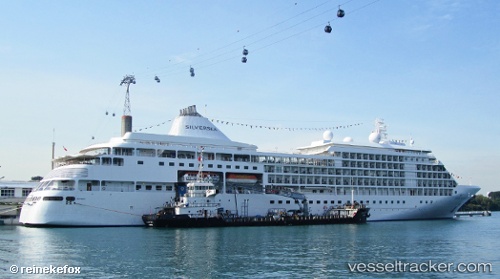
 Silver Shadow
Current Status
Where is the vessel?
Silver Shadow is currently in 11 nm W of San Vincenzo, based on AIS data received less than 1h ago.
Latest AIS update:
Current position: 43.08129° N, 10.29289° E (11 nm W of San Vincenzo)
Average speed (last 7 days): Loading…
Average speed (last 30 days): Loading…
Vessel profile: Silver Shadow is a Cruise Ship with dimensions 186m x 25m.
This page combines live AIS, route history, probable destination signals, nearby traffic, and port activity for practical vessel monitoring.
The current position of vessel Silver Shadow is 43.08129 lat / 10.29289 lng. Updated: 2026-05-12 19:23:14 UTCNearest reference points:
- Near Donoratico
- Near San Vincenzo
- Near Rosignano Solvay
Currently sailing under the flag of Bahamas ![]()
Silver Shadow built in 2000 year
Deadweight:
2980 tDetails:
Live Vessel Silver Shadow Analytics (details, animations, etc.)
Recent AIS points (UTC):
2026-05-12 15:42:34 UTC · 42.81333, 10.32667 · SOG 0 kn · COG -1°2026-05-12 16:57:12 UTC · 42.81300, 10.32631 · SOG 0 kn · COG 137°
2026-05-12 18:10:24 UTC · 42.91181, 10.35668 · SOG 9 kn · COG 353°
2026-05-12 19:23:14 UTC · 43.08129, 10.29289 · SOG 9.2 kn · COG 331°