 vesseltracker.com
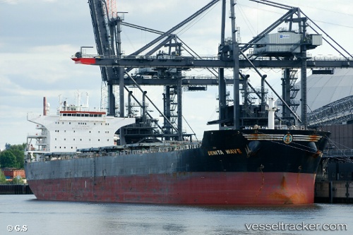
Denita Wave
Current StatusWhere is the vessel?
Denita Wave is currently in 12 nm SE of Bunati, based on AIS data received less than 1h ago.
Latest AIS update:
Current position: 3.92755° S, 115.70813° E (12 nm SE of Bunati)
Average speed (last 7 days): Loading…
Average speed (last 30 days): Loading…
Vessel profile: Denita Wave is a Bulk Carrier with dimensions 38m x 229m.
This page combines live AIS, route history, probable destination signals, nearby traffic, and port activity for practical vessel monitoring.
The current position of vessel Denita Wave is -3.92755 lat / 115.70813 lng. Updated: 2026-05-17 04:43:32 UTCNearest reference points:
- Near Bunati
- 12 nm SE of Bunati
- Near TANJUNG PEMANCINGAN
Details:
Live Vessel Denita Wave Analytics (details, animations, etc.)
Recent AIS points (UTC):
2026-05-17 00:46:33 UTC · -3.92716, 115.70789 · SOG 0 kn · COG 247°2026-05-17 01:34:32 UTC · -3.92775, 115.70813 · SOG 0 kn · COG 261°
2026-05-17 03:58:33 UTC · -3.92762, 115.70813 · SOG 0 kn · COG 259°
2026-05-17 04:43:32 UTC · -3.92755, 115.70813 · SOG 0 kn · COG 255°