 vesseltracker.com
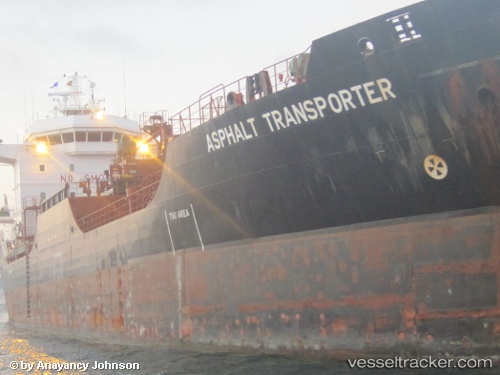
 Asphalt Transporter
Current Status
Where is the vessel?
Asphalt Transporter is currently in 12 nm E of Boyne Island, based on AIS data received less than 1h ago.
Latest AIS update:
Current position: 23.89985° S, 151.57211° E (12 nm E of Boyne Island)
Average speed (last 7 days): Loading…
Average speed (last 30 days): Loading…
Vessel profile: Asphalt Transporter is a Bitumen Tanker with dimensions 108m x 19m.
This page combines live AIS, route history, probable destination signals, nearby traffic, and port activity for practical vessel monitoring.
The current position of vessel Asphalt Transporter is -23.89985 lat / 151.57211 lng. Updated: 2026-05-17 04:19:03 UTCNearest reference points:
- Near Boyne Island
- Near Gladstone Harbor
- Near ROSSLYN
Currently sailing under the flag of Cyprus ![]()
Asphalt Transporter built in 2006 year
Deadweight:
9221 tDetails:
Live Vessel Asphalt Transporter Analytics (details, animations, etc.)
Recent AIS points (UTC):
2026-05-17 01:16:02 UTC · -23.89930, 151.57263 · SOG 0 kn · COG 158°2026-05-17 02:04:02 UTC · -23.89930, 151.57262 · SOG 0 kn · COG 158°
2026-05-17 03:54:59 UTC · -23.89977, 151.57222 · SOG 0 kn · COG 121°
2026-05-17 04:19:03 UTC · -23.89985, 151.57211 · SOG 0 kn · COG 106°