 vesseltracker.com
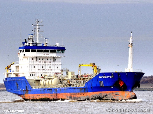
 Capewater
Current Status
Where is the vessel?
Capewater is currently in 16 nm W of Hardelot-Plage, based on AIS data received about 1h ago.
Latest AIS update:
Current position: 50.59179° N, 1.16128° E (16 nm W of Hardelot-Plage)
Average speed (last 7 days): Loading…
Average speed (last 30 days): Loading…
Vessel profile: Capewater is a Chemical Oil Products Tanker with dimensions 100m x 16m.
This page combines live AIS, route history, probable destination signals, nearby traffic, and port activity for practical vessel monitoring.
The current position of vessel Capewater is 50.59179 lat / 1.16128 lng. Updated: 2026-05-17 00:11:30 UTCNearest reference points:
- Near Dungeness
- Near Le Portel
- Near Folkestone
Currently sailing under the flag of Netherlands ![]()
Capewater built in 2009 year
Deadweight:
5180 tDetails:
Live Vessel Capewater Analytics (details, animations, etc.)
Recent AIS points (UTC):
2026-05-16 19:38:21 UTC · 50.14903, -0.02191 · SOG 12.4 kn · COG 359°2026-05-16 21:22:10 UTC · 50.35865, 0.37587 · SOG 11.9 kn · COG 72°
2026-05-16 22:19:31 UTC · 50.41692, 0.65936 · SOG 11.7 kn · COG 73°
2026-05-17 00:11:30 UTC · 50.59179, 1.16128 · SOG 12.2 kn · COG 50°