 vesseltracker.com
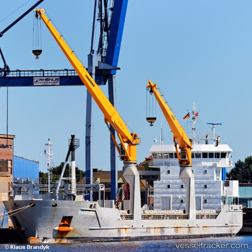
 Bandura
Current Status
Where is the vessel?
Bandura is currently in Near Le Portel, based on AIS data received less than 1h ago.
Latest AIS update:
Current position: 50.76111° N, 1.40547° E (Near Le Portel)
Average speed (last 7 days): Loading…
Average speed (last 30 days): Loading…
Vessel profile: Bandura is a Multi Purpose Carrier with dimensions 118m x 16m.
This page combines live AIS, route history, probable destination signals, nearby traffic, and port activity for practical vessel monitoring.
The current position of vessel Bandura is 50.76111 lat / 1.40547 lng. Updated: 2026-05-18 01:48:05 UTCNearest reference points:
- Near Le Portel
- Near BOULOGNE-SUR-MER
- Near Folkestone
Currently sailing under the flag of Netherlands ![]()
Bandura built in 2010 year
Deadweight:
8217 tDetails:
Live Vessel Bandura Analytics (details, animations, etc.)
Recent AIS points (UTC):
2026-05-17 21:43:19 UTC · 50.34280, 0.15358 · SOG 15 kn · COG 76°2026-05-17 22:43:00 UTC · 50.39857, 0.51940 · SOG 13.9 kn · COG 75°
2026-05-17 23:24:14 UTC · 50.43902, 0.75679 · SOG 13.4 kn · COG 74°
2026-05-18 01:48:05 UTC · 50.76111, 1.40547 · SOG 14 kn · COG 14°