 vesseltracker.com
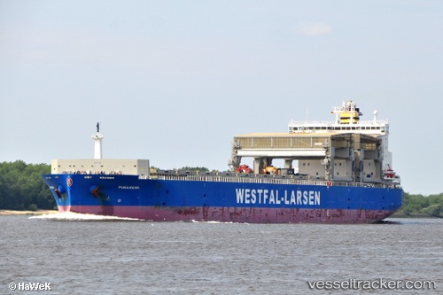
 PANAMANA
Current Status
Where is the vessel?
PANAMANA is currently in 361 nm S of Sao Filipe, based on AIS data received less than 1h ago.
Latest AIS update:
Current position: 8.90562° N, 24.91587° W (361 nm S of Sao Filipe)
Average speed (last 7 days): Loading…
Average speed (last 30 days): Loading…
Vessel profile: PANAMANA is a General Cargo Ship with dimensions 32m x 213m.
This page combines live AIS, route history, probable destination signals, nearby traffic, and port activity for practical vessel monitoring.
The current position of vessel PANAMANA is 8.90562 lat / -24.91587 lng. Updated: 2026-05-17 16:45:02 UTCNearest reference points:
- Open sea, approx. 401 nm off the nearest listed port
- Open sea, approx. 400 nm off the nearest listed port
- Open sea (no nearby ports in database)
Currently sailing under the flag of Norway (NIS) ![]()
PANAMANA built in 2010 year
Deadweight:
54810 tDetails:
Live Vessel PANAMANA Analytics (details, animations, etc.)
Recent AIS points (UTC):
2026-05-17 13:59:07 UTC · 9.47667, -24.63167 · SOG 13 kn · COG -1°2026-05-17 14:20:06 UTC · 9.40500, -24.66833 · SOG 13 kn · COG -1°
2026-05-17 16:20:06 UTC · 8.99167, -24.87500 · SOG 13 kn · COG -1°
2026-05-17 16:45:02 UTC · 8.90562, -24.91587 · SOG 13.4 kn · COG 202°