 vesseltracker.com
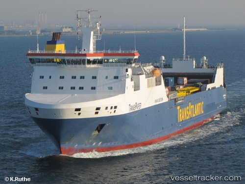
 Tavastland
Current Status
Where is the vessel?
Tavastland is currently in 20 nm S of Kårehamn, based on AIS data received less than 1h ago.
Latest AIS update:
Current position: 56.62404° N, 17.07340° E (20 nm S of Kårehamn)
Average speed (last 7 days): Loading…
Average speed (last 30 days): Loading…
Vessel profile: Tavastland is a Ro Ro Cargo Ship with dimensions 190m x 26m.
This page combines live AIS, route history, probable destination signals, nearby traffic, and port activity for practical vessel monitoring.
The current position of vessel Tavastland is 56.62404 lat / 17.07340 lng. Updated: 2026-05-17 03:45:12 UTCNearest reference points:
- Near Karlskrona
- 31 nm NW of Ustka
- Near RONNEBY
Currently sailing under the flag of Sweden ![]()
Tavastland built in 2006 year
Deadweight:
15960 tDetails:
Live Vessel Tavastland Analytics (details, animations, etc.)
Recent AIS points (UTC):
2026-05-17 00:11:11 UTC · 57.26716, 17.54960 · SOG 11.6 kn · COG 202°2026-05-17 01:47:46 UTC · 56.97697, 17.33617 · SOG 11.6 kn · COG 202°
2026-05-17 01:49:08 UTC · 56.97346, 17.33363 · SOG 11.7 kn · COG 202°
2026-05-17 03:45:12 UTC · 56.62404, 17.07340 · SOG 11.6 kn · COG 202°