 vesseltracker.com
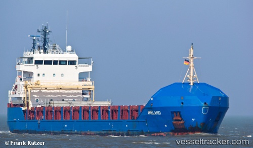
 KAARI
KAARI
Current Status
Where is the vessel?
KAARI is currently in 33 nm SW of Haring, based on AIS data received less than 1h ago.
Latest AIS update:
Current position: 41.20318° N, 11.47939° E (33 nm SW of Haring)
Average speed (last 7 days): Loading…
Average speed (last 30 days): Loading…
Vessel profile: KAARI is a General Cargo with dimensions 116m x 16m.
This page combines live AIS, route history, probable destination signals, nearby traffic, and port activity for practical vessel monitoring.
The current position of vessel KAARI is 41.20318 lat / 11.47939 lng. Updated: 2026-05-17 13:42:36 UTCNearest reference points:
- Near Fiumicino
- Near Santa Marinella
- Near Civitavecchia
Currently sailing under the flag of Antigua Barbuda ![]()
KAARI built in 2009 year
Deadweight:
6390 tDetails:
Live Vessel KAARI Analytics (details, animations, etc.)
Recent AIS points (UTC):
2026-05-17 10:56:43 UTC · 41.25878, 10.80279 · SOG 11.3 kn · COG 96°2026-05-17 11:41:17 UTC · 41.24276, 10.98382 · SOG 11.2 kn · COG 92°
2026-05-17 13:27:26 UTC · 41.20768, 11.41662 · SOG 10.9 kn · COG 92°
2026-05-17 13:42:36 UTC · 41.20318, 11.47939 · SOG 10.8 kn · COG 92°