 vesseltracker.com
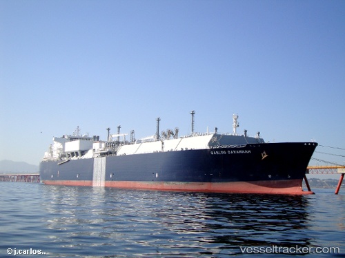
 Gaslog Savannah
Current Status
Where is the vessel?
Gaslog Savannah is currently in 154 nm E of Marsh Harbour, based on AIS data received about 2h ago.
Latest AIS update:
Current position: 27.12500° N, 74.16667° W (154 nm E of Marsh Harbour)
Average speed (last 7 days): Loading…
Average speed (last 30 days): Loading…
Vessel profile: Gaslog Savannah is a Lng Tanker with dimensions 285m x 42m.
This page combines live AIS, route history, probable destination signals, nearby traffic, and port activity for practical vessel monitoring.
The current position of vessel Gaslog Savannah is 27.12500 lat / -74.16667 lng. Updated: 2026-05-18 01:09:17 UTCNearest reference points:
- 113 nm NE of Green Turtle Cay
- 31 nm E of Harbour Island
- 22 nm E of Harbour Island
Currently sailing under the flag of Bermuda ![]()
Gaslog Savannah built in 2010 year
Deadweight:
82291 tDetails:
Live Vessel Gaslog Savannah Analytics (details, animations, etc.)
Recent AIS points (UTC):
2026-05-17 22:09:02 UTC · 26.70667, -75.11833 · SOG 19 kn · COG -1°2026-05-17 22:18:03 UTC · 26.72833, -75.07167 · SOG 19 kn · COG -1°
2026-05-17 23:33:08 UTC · 26.90167, -74.67167 · SOG 18 kn · COG -1°
2026-05-18 01:09:17 UTC · 27.12500, -74.16667 · SOG 18 kn · COG -1°