 vesseltracker.com
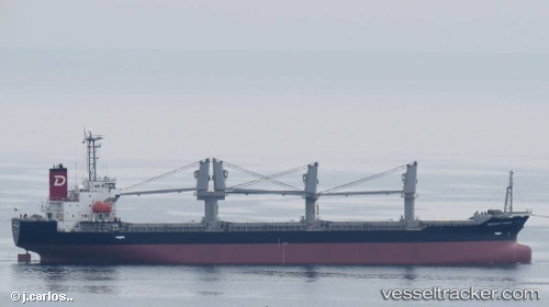
 PARDUS
Current Status
Where is the vessel?
PARDUS is currently in 355 nm E of Luque, based on AIS data received less than 1h ago.
Latest AIS update:
Current position: 23.89037° N, 51.24500° W (355 nm E of Luque)
Average speed (last 7 days): Loading…
Average speed (last 30 days): Loading…
Vessel profile: PARDUS is a Bulk Carrier with dimensions m x m.
This page combines live AIS, route history, probable destination signals, nearby traffic, and port activity for practical vessel monitoring.
The current position of vessel PARDUS is 23.89037 lat / -51.24500 lng. Updated: 2026-05-17 10:16:22 UTCNearest reference points:
- Open sea, approx. 403 nm off the nearest listed port
- Open sea, approx. 409 nm off the nearest listed port
Currently sailing under the flag of Barbados ![]()
Details:
Live Vessel PARDUS Analytics (details, animations, etc.)
Recent AIS points (UTC):
2026-05-17 07:23:24 UTC · 24.27712, -50.76946 · SOG 11.9 kn · COG 230°2026-05-17 07:49:03 UTC · 24.22074, -50.84041 · SOG 12 kn · COG 227°
2026-05-17 09:55:02 UTC · 23.93638, -51.18549 · SOG 12 kn · COG 227°
2026-05-17 10:16:22 UTC · 23.89037, -51.24500 · SOG 11.9 kn · COG 231°