 vesseltracker.com
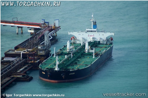
 ACHERON
Current Status
Where is the vessel?
ACHERON is currently in 13 nm N of Oye-Plage, based on AIS data received less than 1h ago.
Latest AIS update:
Current position: 51.19263° N, 1.97257° E (13 nm N of Oye-Plage)
Average speed (last 7 days): Loading…
Average speed (last 30 days): Loading…
Vessel profile: ACHERON is a Crude Oil Tanker with dimensions m x m.
This page combines live AIS, route history, probable destination signals, nearby traffic, and port activity for practical vessel monitoring.
The current position of vessel ACHERON is 51.19263 lat / 1.97257 lng. Updated: 2026-05-17 08:16:22 UTCNearest reference points:
- 15 nm E of RAMSGATE
- 14 nm SE of RAMSGATE
- Near Calais
Currently sailing under the flag of Barbados ![]()
Details:
Live Vessel ACHERON Analytics (details, animations, etc.)
Recent AIS points (UTC):
2026-05-17 04:05:23 UTC · 50.85495, 1.43798 · SOG 8.4 kn · COG 18°2026-05-17 05:29:21 UTC · 51.00045, 1.58673 · SOG 6.9 kn · COG 46°
2026-05-17 07:11:02 UTC · 51.14282, 1.81655 · SOG 6.1 kn · COG 57°
2026-05-17 08:16:22 UTC · 51.19263, 1.97257 · SOG 6.3 kn · COG 58°