 vesseltracker.com
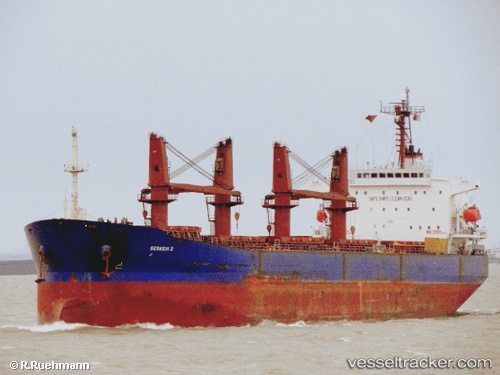
 BAO LI
Current Status
Where is the vessel?
BAO LI is currently in Near Port Raysut, based on AIS data received about 8h ago.
Latest AIS update:
Current position: 16.93917° N, 54.00869° E (Near Port Raysut)
Average speed (last 7 days): Loading…
Average speed (last 30 days): Loading…
Vessel profile: BAO LI is a Bulk Carrier with dimensions m x m.
This page combines live AIS, route history, probable destination signals, nearby traffic, and port activity for practical vessel monitoring.
The current position of vessel BAO LI is 16.93917 lat / 54.00869 lng. Updated: 2026-05-16 21:34:41 UTCNearest reference points:
- 103 nm S of Port Raysut
- 106 nm S of Port Raysut
- 110 nm NE of Gross Koris
Currently sailing under the flag of Panama ![]()
Details:
Live Vessel BAO LI Analytics (details, animations, etc.)
Recent AIS points (UTC):
2026-05-16 21:34:41 UTC · 16.93917, 54.00869 · SOG 0 kn · COG 114°2026-05-16 21:34:41 UTC · 16.93917, 54.00869 · SOG 0 kn · COG 114°
2026-05-16 21:34:41 UTC · 16.93917, 54.00869 · SOG 0 kn · COG 114°
2026-05-16 21:34:41 UTC · 16.93917, 54.00869 · SOG 0 kn · COG 114°