 vesseltracker.com
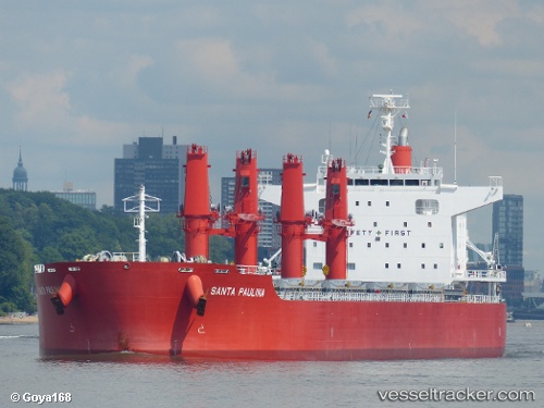
Santa Paulina
Current StatusWhere is the vessel?
Santa Paulina is currently in 56 nm W of Koiingnaas, based on AIS data received about 1h ago.
Latest AIS update:
Current position: 30.17708° S, 16.21016° E (56 nm W of Koiingnaas)
Average speed (last 7 days): Loading…
Average speed (last 30 days): Loading…
Vessel profile: Santa Paulina is a Bulk Carrier with dimensions 32m x 199m.
This page combines live AIS, route history, probable destination signals, nearby traffic, and port activity for practical vessel monitoring.
The current position of vessel Santa Paulina is -30.17708 lat / 16.21016 lng. Updated: 2026-05-17 01:47:41 UTCNearest reference points:
- 154 nm W of Koiingnaas
- 161 nm W of Koiingnaas
- 167 nm SW of Koiingnaas
Details:
Live Vessel Santa Paulina Analytics (details, animations, etc.)
Recent AIS points (UTC):
2026-05-16 22:16:06 UTC · -30.85470, 16.48353 · SOG 12.3 kn · COG 341°2026-05-17 00:11:58 UTC · -30.48535, 16.32477 · SOG 12 kn · COG 341°
2026-05-17 01:46:29 UTC · -30.18090, 16.21160 · SOG 12.3 kn · COG 343°
2026-05-17 01:47:41 UTC · -30.17708, 16.21016 · SOG 12.2 kn · COG 344°