 vesseltracker.com
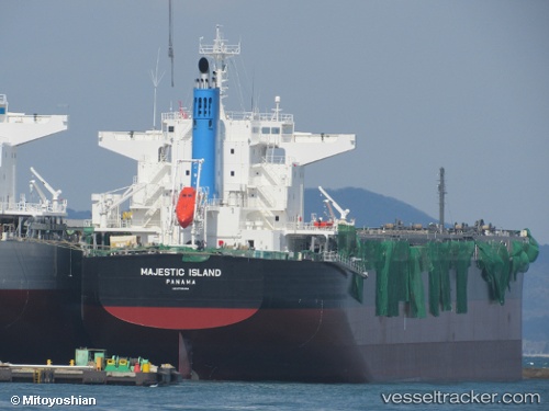
 Majestic Island
Current Status
Where is the vessel?
Majestic Island is currently in 390 nm S of Abakaliki, based on AIS data received less than 1h ago.
Latest AIS update:
Current position: 0.28833° N, 88.38833° E (390 nm S of Abakaliki)
Average speed (last 7 days): Loading…
Average speed (last 30 days): Loading…
Vessel profile: Majestic Island is a Bulk Carrier with dimensions 228m x 32m.
This page combines live AIS, route history, probable destination signals, nearby traffic, and port activity for practical vessel monitoring.
The current position of vessel Majestic Island is 0.28833 lat / 88.38833 lng. Updated: 2026-05-17 17:36:06 UTCNearest reference points:
- Open sea, approx. 402 nm off the nearest listed port
- Open sea, approx. 403 nm off the nearest listed port
- Open sea, approx. 404 nm off the nearest listed port
Currently sailing under the flag of Panama ![]()
Details:
Live Vessel Majestic Island Analytics (details, animations, etc.)
Recent AIS points (UTC):
2026-05-17 14:15:07 UTC · 0.63500, 88.83333 · SOG 10 kn · COG -1°2026-05-17 15:36:04 UTC · 0.49500, 88.65500 · SOG 10 kn · COG -1°
2026-05-17 16:48:04 UTC · 0.37167, 88.49500 · SOG 10 kn · COG -1°
2026-05-17 17:36:06 UTC · 0.28833, 88.38833 · SOG 10 kn · COG -1°