 vesseltracker.com
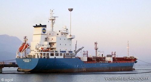
 GIOIA MIA
Current Status
Where is the vessel?
GIOIA MIA is currently in 84 nm N of Maials, based on AIS data received about 1h ago.
Latest AIS update:
Current position: 42.70145° N, 30.78860° E (84 nm N of Maials)
Average speed (last 7 days): Loading…
Average speed (last 30 days): Loading…
Vessel profile: GIOIA MIA is a Oil/Chemical Tanker with dimensions m x m.
This page combines live AIS, route history, probable destination signals, nearby traffic, and port activity for practical vessel monitoring.
The current position of vessel GIOIA MIA is 42.70145 lat / 30.78860 lng. Updated: 2026-05-17 07:44:06 UTCNearest reference points:
- 54 nm SE of Sveti Nikola
- Near Erdemir
- 45 nm N of RUMELI FENERI
Currently sailing under the flag of Palau ![]()
Details:
Live Vessel GIOIA MIA Analytics (details, animations, etc.)
Recent AIS points (UTC):
2026-05-17 04:09:25 UTC · 43.17333, 30.34833 · SOG 9 kn · COG -1°2026-05-17 06:13:55 UTC · 42.89554, 30.61641 · SOG 9.9 kn · COG 145°
2026-05-17 07:21:45 UTC · 42.74574, 30.75037 · SOG 8.5 kn · COG 145°
2026-05-17 07:44:06 UTC · 42.70145, 30.78860 · SOG 8.4 kn · COG 141°