 vesseltracker.com
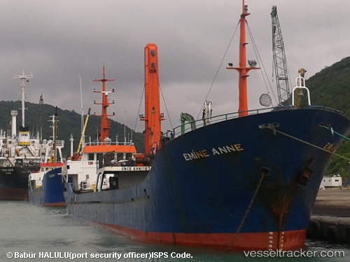
 Emine Anne
Current Status
Where is the vessel?
Emine Anne is currently in 12 nm SE of MANGALIA, based on AIS data received about 1h ago.
Latest AIS update:
Current position: 43.68156° N, 28.80899° E (12 nm SE of MANGALIA)
Average speed (last 7 days): Loading…
Average speed (last 30 days): Loading…
Vessel profile: Emine Anne is a General Cargo Ship with dimensions 69m x 9m.
This page combines live AIS, route history, probable destination signals, nearby traffic, and port activity for practical vessel monitoring.
The current position of vessel Emine Anne is 43.68156 lat / 28.80899 lng. Updated: 2026-05-17 23:39:32 UTCNearest reference points:
- Near Shabla
- 20 nm E of Eforie Sud
- Near Constanta
Currently sailing under the flag of Vanuatu ![]()
Emine Anne built in 1996 year
Deadweight:
1602 tDetails:
Live Vessel Emine Anne Analytics (details, animations, etc.)
Recent AIS points (UTC):
2026-05-17 19:33:13 UTC · 43.32129, 28.49577 · SOG 7.2 kn · COG 51°2026-05-17 21:46:43 UTC · 43.49786, 28.73343 · SOG 6.5 kn · COG 43°
2026-05-17 22:51:03 UTC · 43.59676, 28.79687 · SOG 6.4 kn · COG 8°
2026-05-17 23:39:32 UTC · 43.68156, 28.80899 · SOG 6.1 kn · COG 7°