 vesseltracker.com
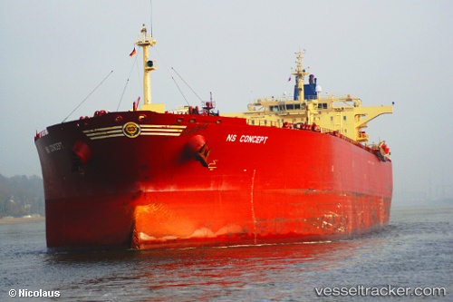
 GUANYIN
Current Status
Where is the vessel?
GUANYIN is currently in 22 nm N of Port Said, based on AIS data received less than 1h ago.
Latest AIS update:
Current position: 31.63257° N, 32.27962° E (22 nm N of Port Said)
Average speed (last 7 days): Loading…
Average speed (last 30 days): Loading…
Vessel profile: GUANYIN is a Crude Oil Tanker with dimensions m x m.
This page combines live AIS, route history, probable destination signals, nearby traffic, and port activity for practical vessel monitoring.
The current position of vessel GUANYIN is 31.63257 lat / 32.27962 lng. Updated: 2026-05-18 07:51:46 UTCNearest reference points:
- 21 nm N of Port Said
- 16 nm N of Port Said
- 15 nm N of Port Said
Currently sailing under the flag of Madagascar ![]()
Details:
Live Vessel GUANYIN Analytics (details, animations, etc.)
Recent AIS points (UTC):
2026-05-18 04:09:42 UTC · 31.63208, 32.27959 · SOG 0 kn · COG 302°2026-05-18 05:54:46 UTC · 31.63221, 32.27971 · SOG 0.1 kn · COG 301°
2026-05-18 07:12:45 UTC · 31.63303, 32.27983 · SOG 0.1 kn · COG 274°
2026-05-18 07:51:46 UTC · 31.63257, 32.27962 · SOG 0 kn · COG 288°