 vesseltracker.com
 CALUMET
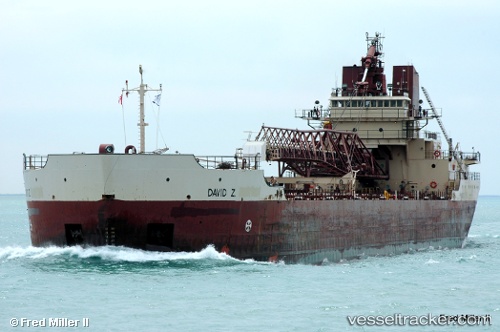
Current Status
Where is the vessel?
CALUMET is currently in 31 nm SE of Ossineke, based on AIS data received less than 1h ago.
Latest AIS update:
Current position: 44.68582° N, 82.77160° W (31 nm SE of Ossineke)
Average speed (last 7 days): Loading…
Average speed (last 30 days): Loading…
Vessel profile: CALUMET is a Self-Discharging Bulk Carrier with dimensions 191m x 192m.
This page combines live AIS, route history, probable destination signals, nearby traffic, and port activity for practical vessel monitoring.
The current position of vessel CALUMET is 44.68582 lat / -82.77160 lng. Updated: 2026-05-17 22:22:25 UTCNearest reference points:
- Near Meldrum
- Near Fort Gratiot
- Near Mackinaw City
Currently sailing under the flag of United States of America ![]()
CALUMET built in 1973 year
Deadweight:
19786 tDetails:
Live Vessel CALUMET Analytics (details, animations, etc.)
Recent AIS points (UTC):
2026-05-17 19:43:29 UTC · 45.17833, -82.95833 · SOG 11 kn · COG -1°2026-05-17 20:10:34 UTC · 45.09500, -82.92833 · SOG 11 kn · COG -1°
2026-05-17 22:10:24 UTC · 44.72345, -82.78517 · SOG 11.6 kn · COG 164°
2026-05-17 22:22:25 UTC · 44.68582, -82.77160 · SOG 11.6 kn · COG 164°