 vesseltracker.com
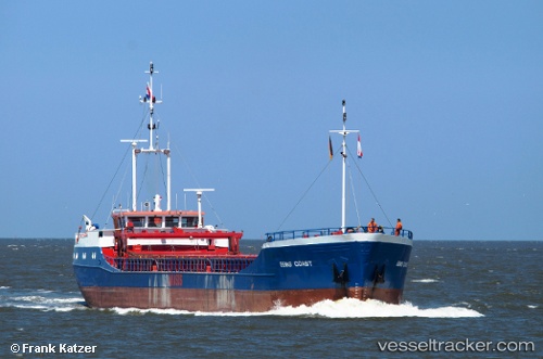
 CM COAST
Current Status
Where is the vessel?
CM COAST is currently in Near Lowestoft, based on AIS data received about 3h ago.
Latest AIS update:
Current position: 52.54602° N, 1.86736° E (Near Lowestoft)
Average speed (last 7 days): Loading…
Average speed (last 30 days): Loading…
Vessel profile: CM COAST is a General Cargo with dimensions m x m.
This page combines live AIS, route history, probable destination signals, nearby traffic, and port activity for practical vessel monitoring.
The current position of vessel CM COAST is 52.54602 lat / 1.86736 lng. Updated: 2026-05-13 05:44:04 UTCNearest reference points:
- Near Oulton Broad
- Near Hemsby
- 11 nm NE of Caister on Sea
Currently sailing under the flag of Antigua and Barbuda ![]()
Details:
Live Vessel CM COAST Analytics (details, animations, etc.)
Recent AIS points (UTC):
2026-05-13 02:16:16 UTC · 52.09962, 1.82809 · SOG 9.2 kn · COG 1°2026-05-13 03:55:47 UTC · 52.33362, 1.84783 · SOG 7.7 kn · COG 5°
2026-05-13 04:07:16 UTC · 52.35775, 1.84917 · SOG 7.4 kn · COG 5°
2026-05-13 05:44:04 UTC · 52.54602, 1.86736 · SOG 6.7 kn · COG 5°