 vesseltracker.com
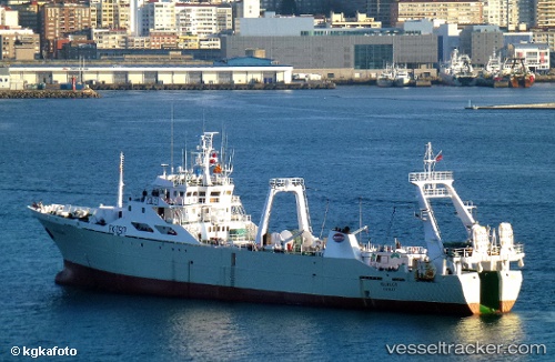
 Igueldo
Current Status
Where is the vessel?
Igueldo is currently in 75 nm SE of Porto Santo Island, based on AIS data received about 1h ago.
Latest AIS update:
Current position: 32.13667° N, 15.35667° W (75 nm SE of Porto Santo Island)
Average speed (last 7 days): Loading…
Average speed (last 30 days): Loading…
Vessel profile: Igueldo is a Fishing Vessel with dimensions 83m x 14m.
This page combines live AIS, route history, probable destination signals, nearby traffic, and port activity for practical vessel monitoring.
The current position of vessel Igueldo is 32.13667 lat / -15.35667 lng. Updated: 2026-05-18 01:24:47 UTCNearest reference points:
- 109 nm E of Porto Santo Island
- 120 nm N of Bañaderos
- 148 nm SE of Porto Santo Island
Currently sailing under the flag of UK ![]()
Igueldo built in 1989 year
Deadweight:
2000 tDetails:
Live Vessel Igueldo Analytics (details, animations, etc.)
Recent AIS points (UTC):
2026-05-17 22:15:45 UTC · 31.49833, -15.69333 · SOG 13 kn · COG -1°2026-05-17 23:29:15 UTC · 31.75062, -15.56242 · SOG 13.4 kn · COG 21°
2026-05-18 01:24:47 UTC · 32.13667, -15.35667 · SOG 13 kn · COG -1°
2026-05-18 01:24:47 UTC · 32.13667, -15.35667 · SOG 13 kn · COG -1°