 vesseltracker.com
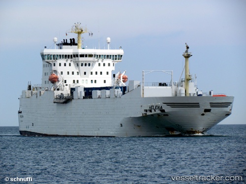
 PEACELAND
Current Status
Where is the vessel?
PEACELAND is currently in Near Sharjah, based on AIS data received less than 1h ago.
Latest AIS update:
Current position: 25.40585° N, 55.19426° E (Near Sharjah)
Average speed (last 7 days): Loading…
Average speed (last 30 days): Loading…
Vessel profile: PEACELAND is a Ro-Ro Cargo with dimensions m x m.
This page combines live AIS, route history, probable destination signals, nearby traffic, and port activity for practical vessel monitoring.
The current position of vessel PEACELAND is 25.40585 lat / 55.19426 lng. Updated: 2026-05-18 04:01:31 UTCNearest reference points:
- Near Free Port
- Near DUBAI
- Near Sharjah
Currently sailing under the flag of Saint Kitts and Nevis ![]()
Details:
Live Vessel PEACELAND Analytics (details, animations, etc.)
Recent AIS points (UTC):
2026-05-17 11:13:08 UTC · 25.67097, 55.21817 · SOG 0.3 kn · COG 102°2026-05-17 11:13:08 UTC · 25.67097, 55.21817 · SOG 0.3 kn · COG 102°
2026-05-17 11:13:08 UTC · 25.67097, 55.21817 · SOG 0.3 kn · COG 102°
2026-05-18 04:01:31 UTC · 25.40585, 55.19426 · SOG 0.2 kn · COG 250°