 vesseltracker.com
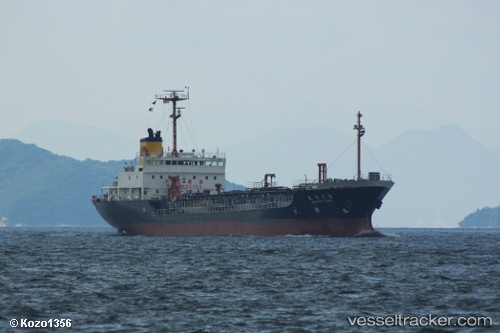
 MT :DING FONT
Current Status
Where is the vessel?
MT :DING FONT is currently in Near Tso-Ying, based on AIS data received about 1h ago.
Latest AIS update:
Current position: 22.72770° N, 120.16712° E (Near Tso-Ying)
Average speed (last 7 days): Loading…
Average speed (last 30 days): Loading…
Vessel profile: MT :DING FONT is a Not available with dimensions m x m.
This page combines live AIS, route history, probable destination signals, nearby traffic, and port activity for practical vessel monitoring.
The current position of vessel MT :DING FONT is 22.72770 lat / 120.16712 lng. Updated: 2026-05-18 01:43:10 UTCNearest reference points:
- Near YUNG AN
- Near Tso-Ying
- Near Kao-Hsiung Kang
Currently sailing under the flag of Sao Tome and Principe ![]()
Details:
Live Vessel MT :DING FONT Analytics (details, animations, etc.)
Recent AIS points (UTC):
2026-05-17 23:02:21 UTC · 22.72768, 120.16796 · SOG 0.2 kn · COG 219°2026-05-17 23:44:09 UTC · 22.72754, 120.16796 · SOG 0.4 kn · COG -1°
2026-05-18 01:43:10 UTC · 22.72770, 120.16712 · SOG 0.5 kn · COG -1°
2026-05-18 01:43:10 UTC · 22.72770, 120.16712 · SOG 0.5 kn · COG -1°