 vesseltracker.com
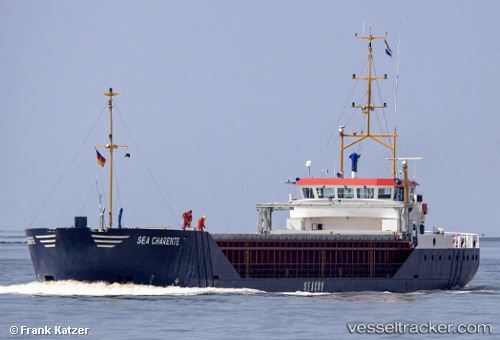
 Sea Charente
Current Status
Where is the vessel?
Sea Charente is currently in 11 nm S of Eastbourne, based on AIS data received less than 1h ago.
Latest AIS update:
Current position: 50.58420° N, 0.24464° E (11 nm S of Eastbourne)
Average speed (last 7 days): Loading…
Average speed (last 30 days): Loading…
Vessel profile: Sea Charente is a General Cargo Ship with dimensions 82m x 11m.
This page combines live AIS, route history, probable destination signals, nearby traffic, and port activity for practical vessel monitoring.
The current position of vessel Sea Charente is 50.58420 lat / 0.24464 lng. Updated: 2026-05-12 21:52:12 UTCNearest reference points:
- 27 nm S of Seaford
- 23 nm S of Poling
- Near Saint Leonards-on-Sea
Currently sailing under the flag of Netherlands ![]()
Sea Charente built in 1996 year
Deadweight:
2100 tDetails:
Live Vessel Sea Charente Analytics (details, animations, etc.)
Recent AIS points (UTC):
2026-05-12 18:12:01 UTC · 50.85010, 1.03031 · SOG 8 kn · COG 234°2026-05-12 19:22:41 UTC · 50.75348, 0.81405 · SOG 8.8 kn · COG 236°
2026-05-12 20:00:11 UTC · 50.70094, 0.69210 · SOG 9 kn · COG 236°
2026-05-12 21:52:12 UTC · 50.58420, 0.24464 · SOG 10.7 kn · COG 253°