 vesseltracker.com
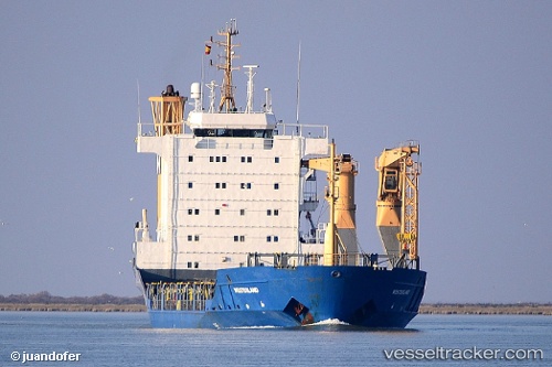
 MARANTA
Current Status
Where is the vessel?
MARANTA is currently in 51 nm E of Hua-Lien Kang, based on AIS data received about 4h ago.
Latest AIS update:
Current position: 23.71074° N, 122.49189° E (51 nm E of Hua-Lien Kang)
Average speed (last 7 days): Loading…
Average speed (last 30 days): Loading…
Vessel profile: MARANTA is a General Cargo with dimensions m x m.
This page combines live AIS, route history, probable destination signals, nearby traffic, and port activity for practical vessel monitoring.
The current position of vessel MARANTA is 23.71074 lat / 122.49189 lng. Updated: 2026-05-13 04:33:32 UTCNearest reference points:
- 26 nm E of Hua-Lien Kang
- Near SUAO
- Near Au-Ao Chaing
Currently sailing under the flag of Cameroon ![]()
Details:
Live Vessel MARANTA Analytics (details, animations, etc.)
Recent AIS points (UTC):
2026-05-13 02:33:40 UTC · 23.96402, 122.56069 · SOG 7 kn · COG 184°2026-05-13 04:33:32 UTC · 23.71074, 122.49189 · SOG 7.9 kn · COG 194°
2026-05-13 04:33:32 UTC · 23.71074, 122.49189 · SOG 7.9 kn · COG 194°
2026-05-13 04:33:32 UTC · 23.71074, 122.49189 · SOG 7.9 kn · COG 194°