 vesseltracker.com
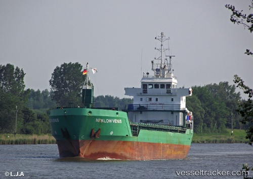
 Hermas
Current Status
Where is the vessel?
Hermas is currently in Near Hunsdon, based on AIS data received less than 1h ago.
Latest AIS update:
Current position: 51.65835° N, 3.31246° E (Near Hunsdon)
Average speed (last 7 days): Loading…
Average speed (last 30 days): Loading…
Vessel profile: Hermas is a Multi Purpose Carrier with dimensions 90m x 14m.
This page combines live AIS, route history, probable destination signals, nearby traffic, and port activity for practical vessel monitoring.
The current position of vessel Hermas is 51.65835 lat / 3.31246 lng. Updated: 2026-05-17 10:11:03 UTCNearest reference points:
- Near Hunsdon
- Near Thorntonbank
- 12 nm NE of Hunsdon
Currently sailing under the flag of Cyprus ![]()
Hermas built in 2000 year
Deadweight:
4903 tDetails:
Live Vessel Hermas Analytics (details, animations, etc.)
Recent AIS points (UTC):
2026-05-17 05:28:59 UTC · 51.81727, 3.37659 · SOG 0 kn · COG 203°2026-05-17 07:11:12 UTC · 51.81605, 3.37513 · SOG 0.3 kn · COG 133°
2026-05-17 08:12:17 UTC · 51.81423, 3.37607 · SOG 0.2 kn · COG 54°
2026-05-17 10:11:03 UTC · 51.65835, 3.31246 · SOG 11.3 kn · COG 141°