 vesseltracker.com
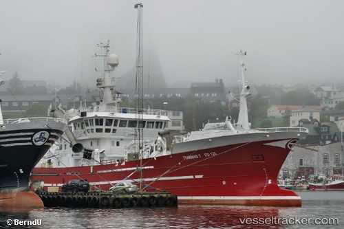
 Tummas T
Current Status
Where is the vessel?
Tummas T is currently in 55 nm NE of Thorshavn, based on AIS data received less than 1h ago.
Latest AIS update:
Current position: 62.46379° N, 4.39108° W (55 nm NE of Thorshavn)
Average speed (last 7 days): Loading…
Average speed (last 30 days): Loading…
Vessel profile: Tummas T is a Fish Carrier with dimensions m x m.
This page combines live AIS, route history, probable destination signals, nearby traffic, and port activity for practical vessel monitoring.
The current position of vessel Tummas T is 62.46379 lat / -4.39108 lng. Updated: 2026-05-17 04:10:01 UTCNearest reference points:
- Near FUGLAFJORDUR
- 36 nm NW of Ham Voe, Foula
- 32 nm NW of Eshaness
Currently sailing under the flag of Faroe Is ![]()
Tummas T built in 2002 year
Details:
Live Vessel Tummas T Analytics (details, animations, etc.)
Recent AIS points (UTC):
2026-05-17 01:26:01 UTC · 62.45536, -3.68847 · SOG 7.7 kn · COG 270°2026-05-17 02:12:01 UTC · 62.45814, -3.89854 · SOG 7.2 kn · COG 271°
2026-05-17 03:39:59 UTC · 62.46076, -4.26911 · SOG 6.7 kn · COG 282°
2026-05-17 04:10:01 UTC · 62.46379, -4.39108 · SOG 7 kn · COG 283°