 vesseltracker.com
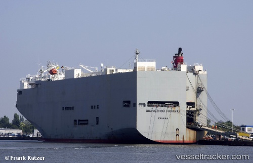
Guangzou Highway
Current StatusWhere is the vessel?
Guangzou Highway is currently in 26 nm S of Kikaishima, based on AIS data received about 7h ago.
Latest AIS update:
Current position: 27.87729° N, 129.94669° E (26 nm S of Kikaishima)
Average speed (last 7 days): Loading…
Average speed (last 30 days): Loading…
Vessel profile: Guangzou Highway is a Vehicles Carrier with dimensions 40m x 180m.
This page combines live AIS, route history, probable destination signals, nearby traffic, and port activity for practical vessel monitoring.
The current position of vessel Guangzou Highway is 27.87729 lat / 129.94669 lng. Updated: 2026-05-16 21:48:28 UTCNearest reference points:
- 18 nm W of Koniya
Details:
Live Vessel Guangzou Highway Analytics (details, animations, etc.)
Recent AIS points (UTC):
2026-05-16 21:48:28 UTC · 27.87729, 129.94669 · SOG 15.9 kn · COG 222°2026-05-16 21:48:28 UTC · 27.87729, 129.94669 · SOG 15.9 kn · COG 222°
2026-05-16 21:48:28 UTC · 27.87729, 129.94669 · SOG 15.9 kn · COG 222°
2026-05-16 21:48:28 UTC · 27.87729, 129.94669 · SOG 15.9 kn · COG 222°