 vesseltracker.com
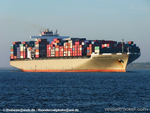
 Henry Hudson
Current Status
Where is the vessel?
Henry Hudson is currently in 111 nm SW of Los Ramos, based on AIS data received less than 1h ago.
Latest AIS update:
Current position: 36.77742° N, 12.11371° W (111 nm SW of Los Ramos)
Average speed (last 7 days): Loading…
Average speed (last 30 days): Loading…
Vessel profile: Henry Hudson is a Container Ship with dimensions 336m x 46m.
This page combines live AIS, route history, probable destination signals, nearby traffic, and port activity for practical vessel monitoring.
The current position of vessel Henry Hudson is 36.77742 lat / -12.11371 lng. Updated: 2026-05-16 22:09:48 UTCNearest reference points:
- 118 nm NE of Nedroma
- 116 nm NE of Nedroma
- 115 nm E of Nedroma
Currently sailing under the flag of Panama ![]()
Henry Hudson built in 2008 year
Deadweight:
98849 tDetails:
Live Vessel Henry Hudson Analytics (details, animations, etc.)
Recent AIS points (UTC):
2026-05-16 17:46:18 UTC · 35.55264, -12.55026 · SOG 17.3 kn · COG 15°2026-05-16 19:38:27 UTC · 36.07799, -12.36877 · SOG 17.4 kn · COG 14°
2026-05-16 22:07:33 UTC · 36.76667, -12.11667 · SOG 17 kn · COG -1°
2026-05-16 22:09:48 UTC · 36.77742, -12.11371 · SOG 17.4 kn · COG 12°