 vesseltracker.com
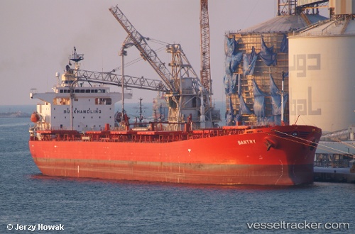
Bantry
Current StatusWhere is the vessel?
Bantry is currently in 164 nm NW of Mutineer, based on AIS data received less than 1h ago.
Latest AIS update:
Current position: 18.06605° S, 114.01833° E (164 nm NW of Mutineer)
Average speed (last 7 days): Loading…
Average speed (last 30 days): Loading…
Vessel profile: Bantry is a Bulk Oil Carrier with dimensions 33m x 225m.
This page combines live AIS, route history, probable destination signals, nearby traffic, and port activity for practical vessel monitoring.
The current position of vessel Bantry is -18.06605 lat / 114.01833 lng. Updated: 2026-05-18 01:47:04 UTCDetails:
Live Vessel Bantry Analytics (details, animations, etc.)
Recent AIS points (UTC):
2026-05-17 22:12:04 UTC · -17.45488, 114.12725 · SOG 10.2 kn · COG 192°2026-05-18 00:03:34 UTC · -17.77257, 114.07195 · SOG 10.2 kn · COG 192°
2026-05-18 01:35:56 UTC · -18.03392, 114.02405 · SOG 10.3 kn · COG 191°
2026-05-18 01:47:04 UTC · -18.06605, 114.01833 · SOG 10.5 kn · COG 191°