 vesseltracker.com
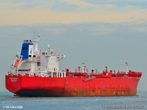
 Idi
Idi
Current Status
Where is the vessel?
Idi is currently in 31 nm NW of Bnei Darom, based on AIS data received about 1h ago.
Latest AIS update:
Current position: 32.26723° N, 31.40068° E (31 nm NW of Bnei Darom)
Average speed (last 7 days): Loading…
Average speed (last 30 days): Loading…
Vessel profile: Idi is a Chemical Oil Products Tanker with dimensions 183m x 183m.
This page combines live AIS, route history, probable destination signals, nearby traffic, and port activity for practical vessel monitoring.
The current position of vessel Idi is 32.26723 lat / 31.40068 lng. Updated: 2026-05-18 02:19:22 UTCNearest reference points:
- Near Damietta
- 21 nm N of Port Said
- 15 nm N of Port Said
Currently sailing under the flag of Marshall Is ![]()
Idi built in 2007 year
Deadweight:
46575 tDetails:
Live Vessel Idi Analytics (details, animations, etc.)
Recent AIS points (UTC):
2026-05-17 23:06:12 UTC · 32.75778, 30.89005 · SOG 12.5 kn · COG 135°2026-05-17 23:40:42 UTC · 32.66560, 30.97802 · SOG 12.3 kn · COG 139°
2026-05-18 02:17:51 UTC · 32.27018, 31.39905 · SOG 11.7 kn · COG 141°
2026-05-18 02:19:22 UTC · 32.26723, 31.40068 · SOG 11.7 kn · COG 142°